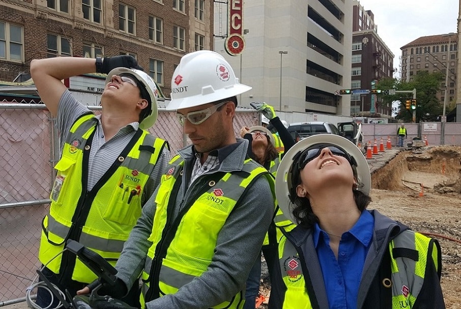
Members of our team working on the Canopy Hilton along San Antonio’s historic River Walk recently took to the skies to avoid problems on the ground.
Continuous Improvement Program Manager Dominic Daughtrey held a training session with newly licensed drone pilots Senior Virtual Construction Engineer Mark Epstein and Engineering Interns Meagan Garcia and Matt Huffine for about 90 minutes using our DJI Phantom Pro 4 Obsidian.
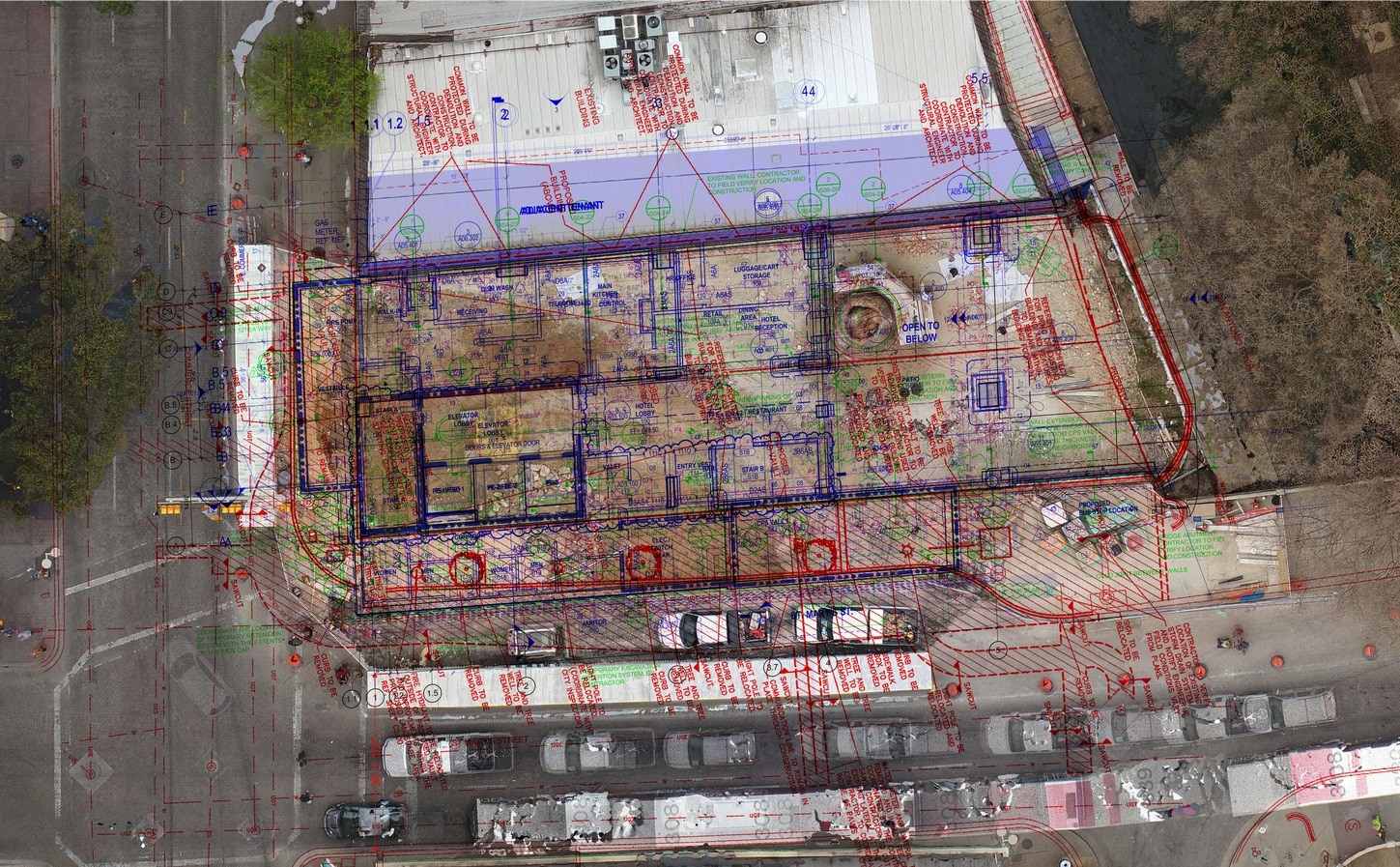
Flights will take place before concrete is poured for the post-tension decks. The drone will be used to spot-check slab penetrations and sleeve locations, ensuring utilities are in the correct places and slab box-outs are the proper size before concrete is poured. Each time a clash is found in a post-tension slab, it costs the project between $10,000 and $50,000 to repair or resolve.
“With an incredibly complex project, it is one of our major goals to discover these clashes before they are constructed in the field,” Mark said. “Flights will also be performed following the concrete pour to monitor project progress, inspection and quality control.”
The craft will capture dozens of photographs and combine them using a program called Pix4D to create a jobsite orthomosaic, an aerial photograph geometrically corrected so the scale is uniform. Think Google satellite image (plan view) with 4K resolution. These plan views can also be geo-located with the use of precise ground control points. Aerial photographs are used to create a point cloud of the existing conditions and surrounding structures. A point cloud is a three-dimensional image and model that is created from the photographs based on the distance of the existing element from the drone. The model can be imported into the architect’s model to verify existing conditions and locations.
“On the Canopy project, we have a neighboring structure with a wall that is about 150 years old,” Mark said. “We’ve fully documented the existing conditions of that wall for any future questions, claims or otherwise. We’ve also created a point cloud model of it which accurately illustrates the location and will be used to proactively investigate constructability concerns.”
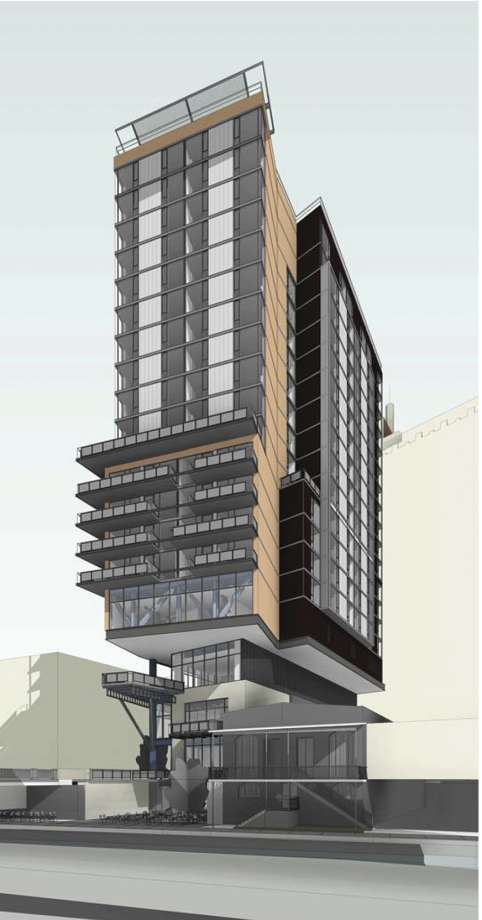
The hotel is one of the most high-profile projects going on in San Antonio. The 22-story facility will feature more than 3,000 square feet of meeting space, 195 guest rooms and a restaurant with an outdoor terrace overlooking the River Walk.